About Live Nature Maps

A wildlife reporting, mapping, and alert platform designed specifically for nature organizations.

What Is Live Nature Maps?

Live Nature Maps allows organizations to collect wildlife observations from members, display reports on interactive maps, and distribute alerts when significant sightings occur.

The platform is currently deployed through Essex Birds and is designed to be adapted for birding clubs, naturalist organizations, butterfly groups, dragonfly projects, and conservation initiatives.

How Deployments Work

A Local Organization Sponsors the Platform

Each Live Nature Maps deployment is funded by a local organization such as a bird club, naturalist group, conservation authority, municipality, park, or other nature-focused organization. The sponsoring organization customizes the platform with its own branding, reporting area, species lists, and notification rules. Reporting area can be a county, conservation area, club area, or other geographic region.

Open to Everyone

Once launched, the reporting map is available to everyone visiting the regionβ€”not just members of the sponsoring organization. Birders, photographers, hikers, and other nature enthusiasts can all submit sightings, view reports, and receive alerts, helping build a richer picture of local wildlife activity.

A Better Community Resource

Every new report benefits the entire community by providing:

  • Real-time wildlife sightings
  • Interactive community maps
  • Instant alerts for significant observations
  • A growing historical record of local wildlife

The sponsoring organization provides the platform, while the entire community helps make it successful.

Essex Birds is the first public deployment of the Live Nature Maps platform and demonstrates how a regional organization can make real-time wildlife reporting available to the entire community.

How It Works

From report to alert in seconds.

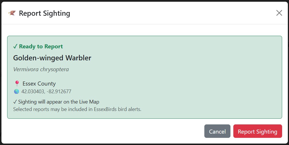
Wildlife report form

Report Species in Field

Users quickly submit wildlife observations from any device, right from the location of the sighting.

↓
Wildlife report form

Report

App auto captures GPS location, and sends it with species full name to the map.

↓
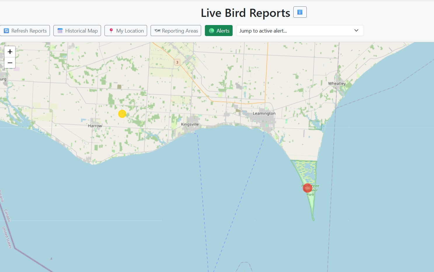
Live wildlife map

Display

Reports instantly appear on the live community map.

↓
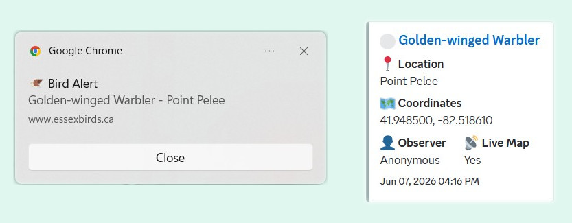
Rare bird notification

Alert

Browser notifications and Discord alerts are sent automatically with exact time and coordinates.

How Is This Different?

Live Nature Maps is designed to complement platforms like eBird and iNaturalist, not replace them.

eBird / iNaturalist

  • Long-term records
  • Research databases
  • Historical observations
  • Species tracking

Designed For

πŸ¦… Birding Clubs
πŸ¦‹ Butterfly Monitoring
πŸ‰ Dragonfly Projects
🌿 Naturalist Organizations
🌎 Conservation Groups
🏞️ Regional Nature Networks
LIVE DEPLOYMENT

Essex Birds

The first Live Nature Maps deployment, serving birders across Essex County with real-time sighting reports, interactive mapping, browser notifications, Discord alerts, and community reporting tools.

πŸ—ΊοΈ Live Maps
πŸ”” Rare Bird Alerts
πŸ‘₯ Community Reporting
Visit Essex Birds β†’

Active Development

Enhanced mapping tools
Additional wildlife groups
Expanded notification systems
Organization-specific customization

Interested In A Pilot Deployment?

We are currently looking for organizations interested in bringing real-time wildlife reporting and mapping to their communities.

Contact Us